
Dry weather reveals lost gardens and monastic buildings
Hot, dry weather has traced the outlines of a vanished garden and demolished buildings across lawns in southern England. Accounts from Blenheim Palace and the National Trust describe how parch marks temporarily reveal archaeological remains beneath apparently open ground.
- Parch marks have traced a vanished formal garden at Blenheim Palace and buried buildings at other southern English estates.
- Grass above shallow foundations dries differently, making underground layouts visible during prolonged dry weather.
- - The outlines complement earlier surveys, but some buildings’ dates and relationships still require archaeological investigation.
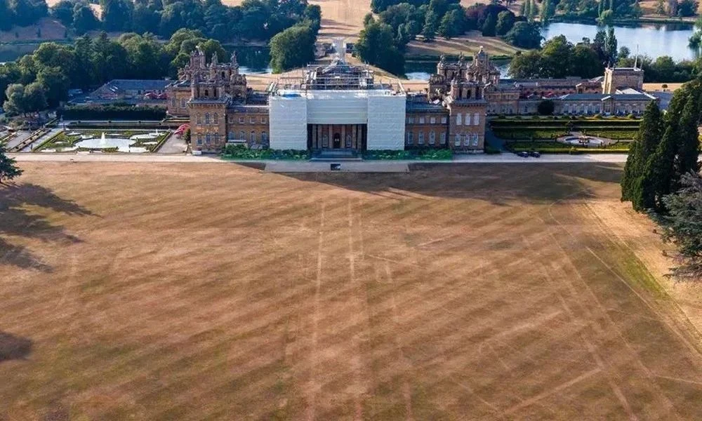
At Blenheim Palace in Oxfordshire, the marks outline an eighteenth-century parterre: an ornamental garden arranged around beds, paths and symmetrical patterns. Created in 1705 by royal gardener Henry Wise, it extended across the palace’s width and was enclosed by a substantial stone wall. The garden disappeared during Lancelot “Capability” Brown’s transformation of the landscape in the 1760s. Head gardener Andy Mills described the visible footprint as an opportunity to appreciate the original design’s intricate layout and scale.
The effect depends on differences in the ground beneath the grass. Where masonry survives close to the surface, the soil above it is thinner and retains less moisture. Vegetation there can dry faster than neighbouring grass, producing lines and right angles corresponding to buried foundations. The resulting patterns make structures visible without exposing their stonework, although interpreting their date and purpose still requires supporting evidence.
At Greys Court, near Henley-on-Thames, marks across the Oval Lawn have been associated with buildings that once formed part of the historic complex. The supplied account identifies sixteenth-century ranges that may have connected sides of an earlier courtyard. Heritage records document previous parch-mark observations and archaeological investigations, demonstrating that these buried structures have attracted attention over several decades. Their outlines add to an already complicated picture of rebuilding around the surviving house.
You Might Also Like


At Mottisfont, near Romsey in Hampshire, the National Trust identifies thirteenth- and sixteenth-century wall foundations beneath the south lawn. They relate to the medieval monastic complex, including a cloister, and subsequent Tudor alterations. Later remodelling left portions buried beneath the grounds. Archaeologist James Brown has highlighted the value of these intermittent views, while the Trust’s heritage record notes that geophysical surveys have not been followed by systematic excavation of the buried complex. The precise relationships between some features therefore remain uncertain.